Hull’s Water Heritage
Hull’s drains: shaping the city
A city built around water.
Centuries of Water Management
Water has shaped Hull for centuries.
Much of the land surrounding Hull was originally low-lying marshland. Over hundreds of years, networks of drains, ditches and watercourses were created to move water away from homes, farmland and communities. Some of the earliest drainage works date back to medieval times and helped make the area suitable for farming, transport and future development.
Historical Maps
The River Hull Valley has changed significantly over time.
These maps show how drainage works transformed a largely wetland landscape into the managed network of drains, watercourses and farmland seen today, helping shape the communities and environment of the East Riding and Hull. (Source: ERYC)
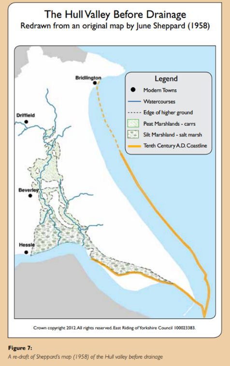
The Hull Valley Before Drainage
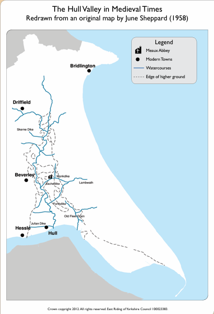
The Hull Valley in Medieval Times
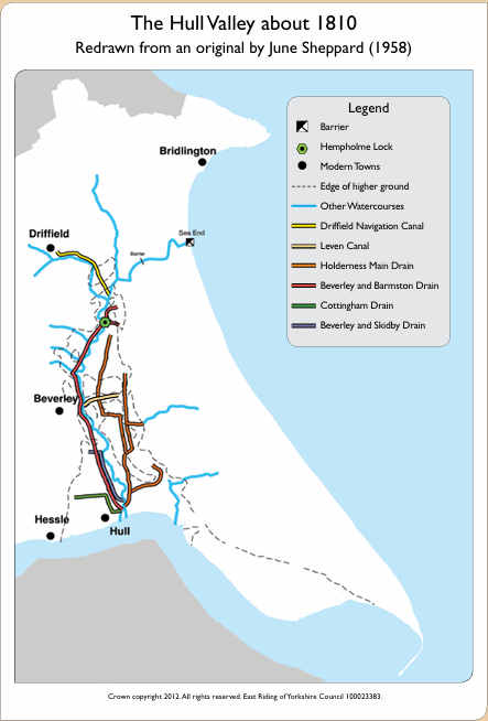
The Hull Valley About 1810
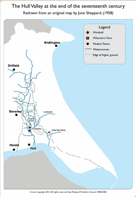
The Hull Valley at the End of the Seventeenth Century
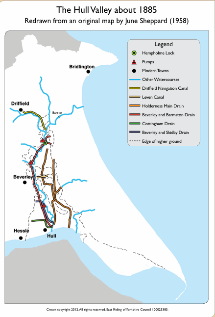
The Hull Valley About 1885
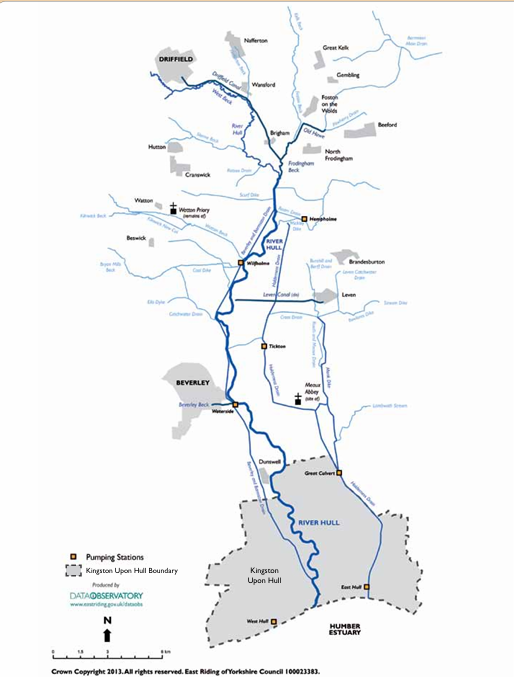
Historical Hull Valley Map
19th & 20th Century Expansion
How the drainage network changed
Urban Development
As Hull expanded during the 19th and 20th centuries, many open drains were built over, diverted or enclosed to make way for housing, roads and industry. Some historic watercourses disappeared from view altogether, although they remained part of the city’s drainage network beneath the surface.
Today, much of this infrastructure is hidden from view and is facing increasing pressure from heavier rainfall and climate change. Hull’s drains continue to play a vital role in storing and moving water around the city, helping to reduce flood risk and support resilient communities.
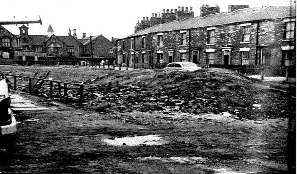
Image: Cottingham Drain being filled in during 1963, illustrating how parts of Hull’s historic drainage network disappeared from view as the city developed.
Flood Resilience & Lessons
Learning from the past
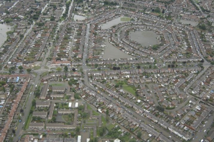
Image: Aerial photograph showing widespread flooding across Hull during the summer floods of 2007, when around 8,500 homes and businesses were affected.
Living With Water
Hull has a long history of living with water. Its low-lying location, combined with the Humber Estuary, the River Hull and an extensive drainage network, means managing water will always be important.
Major flood events, including the floods of 2007, highlighted the need for investment in flood resilience and sustainable water management. Since then, organisations across the region have continued to work together to reduce flood risk and improve the way water is managed, for example through the Living with Water partnership.
Hull’s Dynamic Drains
Reconnecting with Hull’s water heritage
Hull’s Dynamic Drains is helping people rediscover the city’s historic watercourses.
Walking trails, interpretation boards and community projects are encouraging residents to learn more about local history, wildlife and the important role drains continue to play in managing water and supporting communities today.
Project Partners
Project Partners
Hull’s Dynamic Drains is led by the Environment Agency and delivered in partnership with Hull City Council , Groundwork Yorkshire and Yorkshire Wildlife Trust .