Hull’s Dynamic Drains
Saltshouse Road
Discover the history of Saltshouse Road, from its origins as the Bilton Road and the grand houses of Sutton to the development of Longhill and Western Gailes.
Holderness Drain locations
Originally without an official name, this road was just referred to as the Bilton Road – literally the road that leads to the village of Bilton to the east.
Sutton, part of Hull since 1929, was one of the largest villages in the whole of Holderness. In the 18th Century it became one of the refuges for many of the wealthy merchants fleeing the smells and filth of the old town of Hull. Consequently, many very grand houses were built in the vicinity of the ancient village. Many of these were located along ‘the Bilton Road’, east of the village. One of these large houses, known as Salts-House, was still standing in the late 19th Century, named as such most likely as it stood within the ‘salts’ (fields). As a result, the Bilton Road in part became known as Saltshouse Lane here.
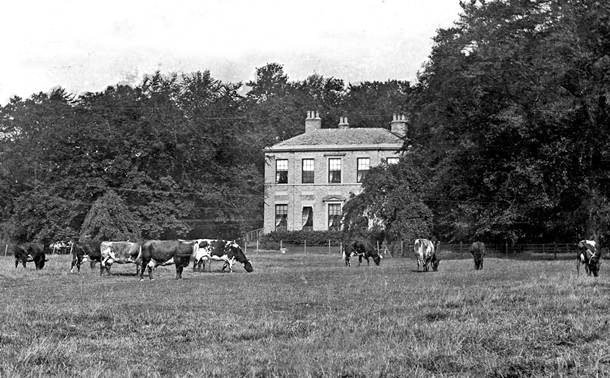
The vital drainage of the Sutton area had begun in the late 18th Century with the construction of the Foredyke Drain, confusingly more well-known as the Foredyke Stream, to the south of the village, which also ran to the Humber.
The name Saltshouse relates to the low-quality pastures in the vicinity were known as the ‘Salts’. The poor quality, salty, nature of the pastureland here was because of the frequent salt-water floods from the Humber. The Holderness Drain – formerly the route of the ancient River Wilflete – that passes here, was created in the 1830s to alleviate the mass flooding. The road, or lane itself is probably of 17th Century in origin if not earlier. The 1852 ordnance survey map of the area shows the original bridge over the drain here named as ‘Salts House Bridge’, and it was still shown under that name into the 1940s.
At the entrance to Saltshouse Road, at the junction with Holderness High Road, remains Eastfield Cottage – 1191 Holderness Road – which dates from 1600 although much altered over the centuries), and Eastfield House – 1189 Holderness Road (a funeral directors’ and known as no.3 Saltshouse Road) which dates from c.1680. This property was shown as ‘Salts House’ on the 1852 map of the area and on the 1890 map. However, the term Salts House was used for several properties; just further east along the Holderness Road was ‘Salts Cottage’ also. These are by far the oldest remaining houses on Holderness Road.
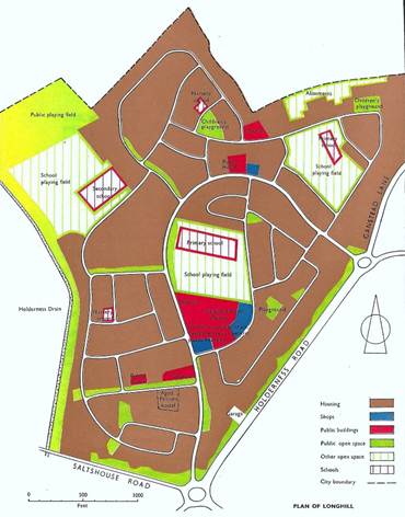
Longhill Estate (another ancient field name re-used) was constructed between 1952 and 1959 to the east side of the drain. Evidence of Romano-British settlement were found during the development of a school on the estate. The last remaining fields around the old roadway were lost to the Western Gailes housing estate, Wilberforce Sixth Form College, the Royal Charter pub, and shops within the last three decades.
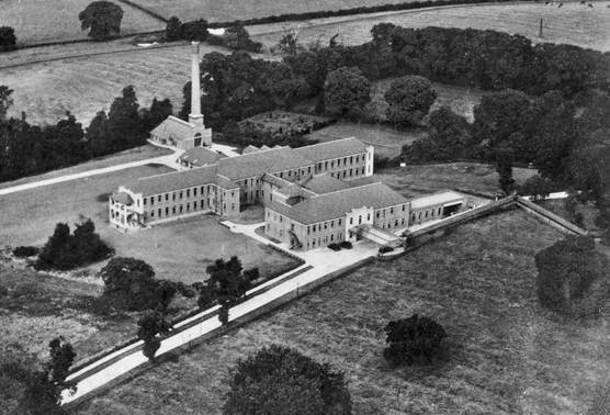
The eastern portion of the Western Gailies, west of the drain, was built on the site of the area’s most well-known building; the former Sutton Annexe of the Hull Royal Infirmary (1928-2008), that was demolished in 2012.
Changing landscape
Saltshouse Road through time
From the old Bilton Road and the grand houses of Sutton to the development of Longhill and Western Gailes, Saltshouse Road reflects the changing landscape of East Hull.
Explore Holderness Drain
Project Partners
Hull’s Dynamic Drains is led by the Environment Agency and delivered in partnership with Hull City Council , Groundwork Yorkshire and Yorkshire Wildlife Trust .